Lawson Creek Watershed
Summary
Characteristics
- Seventh largest watershed in West Vancouver
- Bordered by the MacDonald Creek watershed to the west and the Brothers Creek and Vinson Creek watersheds in the east in West Vancouver, BC
- Originates on Hollyburn Ridge south of the Westlake Lodge
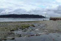
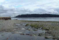
- Discharges into Burrard Inlet just west of John Lawson park at the foot of 18th Street
- Blue Gentian Lake, other small lakes and tributaries in upper watershed
- Two branches in upper watershed; east branch is the largest, west branch has the steepest slope
- West branch tributary enters at Douglas Woodward Park, above Upper Levels highway
- Full urban development to the 366 m (1200 ft) limit of development
- Sixty percent of the watershed is natural forest above the 366 m limit of development
- Stream profile steepest above highway, at 17-25% slope, below highway slope is between 15 and 17%, to 6% in lower watershed
- 71% riparian forest coverage over entire watershed
- Urban riparian zones are sporadic and isolated along narrow stream corridors or in parks
- Rare King Gentian and Three-leaved Goldenthread at Blue Gentian Lake
- Underground storm drains in development above highway and in lower watershed, roadside ditches in older residential areas below highway
- Diversion pipe for high (100-year) flow, inlet at Inglewood Avenue, another inlet proposed upstream of development
- 50% of impervious surfaces drain to pervious ditches and detention ponds
- Retention ponds in Westhill development above highway
- Watershed underlain by up to 25 m of low permeability till, isolated granular deposits with slow permeability (>1.5 m) and moderately permeable soil (0.5 m)
- Concrete flume 100 m long at mouth
- Twenty culverts and bridges, 20 privately owned pedestrian bridges
- Total impervious area over entire watershed 15%
History:
- Creek named for John Lawson
- District Lot 775 at mouth pre-empted by Jason Blake in 1872, transferred to John “Navvy Jack” Thomas later that year. Site of the first permanent residence west of the narrows. First piped water supply in West Vancouver from small dam in creek to house and barn.
- John Lawson bought and developed land between 16th and 22nd Streets and north to Haywood Avenue for summer use by Vancouver residents
- Area logged in 1870. Around 1912, a wooden flume was used to transport wood to head of Lawson Creek and sent down to a mill pond where Vedder River Shingle Company made shingles. The mill pond was at Inglewood Avenue and 17th Street and operated until 1923
- Development in upper watershed began with Chartwell (early 1960’s), expanded Upper Levels highway (1972), Panorama Village (1974) and Westhill Subdivision (1978)
- Flooded Ambleside between Marine Drive and railway tracks in 1981 due to blocked culvert at 18th Street and Marine Drive. Railway acted as dyke to prevent drainage
Watershed Use:
- Residential
- Commercial at Marine Drive
- Park: John Lawson Park, Douglas Woodward Park, Shields Dam Park, Normanby Park, Cypress Provincial Park
- Recreational: Baden Powell Trail, Skyline Trail, TransCanada Trail, Millstream Trail, cross-country ski trails, mountain biking
- Fish: cutthroat trout
- Wildlife: tailed frog found in East Branch above Cammeray Avenue, diverse populations of mammal, bird and amphibian inhabit the watershed
- Vegetation: subalpine forests of mountain hemlock and yellow cedar above 650 m; second-growth red alder, Douglas fir or mixed forests in headwaters; sporadic in developed area, mostly along narrow stream corridors or in parks
- Train and automobile transportation, Trans Canada Trail, hydro lines
- Deep well at West Vancouver Secondary School with artesian pressure of 9 m above ground used as supply source for heat exchange/cooling system
Concerns:
- Obstructions and barriers to fish passage include:
- 220 m culvert between Belleview Ave and Duchess Ave due to internal flow velocity that exceeds the swimming speed of adult fish and steep concrete inlet structure
- Inglewood Avenue due to tendency for debris to build up at the inlet
- Mathers Avenue due to 90 cm outlet drop and steep inlet gradient
- Queens Avenue due to over 2 m drop at outlet
- Upper Levels highway culvert of unknown length and steepness
- East Branch: Camridge Avenue culvert impassible to cutthroat
- West Branch: 2.5 m high waterfall about 40 m upstream of confluence prevent upstream movement of cutthroat
- Macroinvertibrate sampling (B-IBI score) classified creek as “poor-fair” in health
- Channelization of creek and loss of tributaries through urban area
- Large woody debris rare in urban watershed
- Water Quality:
- altered through proximity to urban development and storm drain discharge
- possibility of sewer lines breakages
Key Interest Groups:
- Municipal: District of West Vancouver, District Parks Department
- Federal: Department of Fisheries and Oceans
- Provincial: Ministry of Transportation and Highways; Ministry of Water, Land and Air Protection
- West Vancouver Streamkeeper Society
- Cypress Bowl Recreation, mountain biking associations, cross-country ski clubs
- BC Rail, BC Hydro
- Ambleside and Dundarave Ratepayers Association
Watershed Projects:
- Biophysical survey, 1977 [FISS]
Recommendations for Further Actions:
- Develop standards for backyard landscaping and initiate public education program about watershed
- Develop policy to protect existing ditches from being replaced with culverts
Available Sources of Information:
Web Sites:
Reports:
- Lower Fraser Valley Stream Review, Vol. 1. Fisheries and Oceans Canada. Fraser River Action Plan, 1999
- Wild Threatened, Endangered and lost Streams of the Lower Fraser Valley, Summary Report. Fisheries and Oceans Canada. Fraser River Action Plan, 1997
- Creeks in West Vancouver. Hugh Johnston?, 1990
- West Vancouver Drainage. Dayton and Knight, 1973
- Task Force Inquiry into Drainage Policies and Problems. District of West Vancouver, 1977
- The Lawson Creek Flood, 1981: Debris Flood in West Vancouver, B.C. R. L. Begshaw, 1982
- McDonald and Lawson Creeks Integrated Stormwater Management Plan, Draft Report. Kerr Wood Leidal Associates Ltd., 2002
- Old Growth Inventory of Southern Cypress Provincial Park. D. J. Karasiuk
- Environmental Analysis and Development Guidelines for Lands above the Upper Levels Highway: Lawson Creek to Marr Creek. Environmental Research Consultants, 1977
Prepared by Elizabeth Hardy, March 2003