Lawson Creek Watershed
Summary
Characteristics
- Seventh largest watershed in West Vancouver
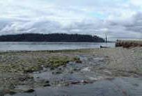
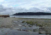
- Originates on Hollyburn Ridge south of the Westlake Lodge. Creek flows down forested mountainside, through Blue Gentian Lake and other small lakes, before emerging in the urban area at Pinecrest Drive. Creek flows under Chippendale and Camridge Avenues before being culverted under the Upper Levels highway. Creek is culverted under Queens and Mathers Avenues, flows past West Vancouver Secondary School and under Inglewood and Fulton Avenues. Culverts and concrete flumes carry the creek past Ambleside commercial district to the cobble beach on Burrard Inlet just west of John Lawson park at the foot of 18th Street
Watershed Use
- Residential
- Commercial at Marine Drive
- Recreation: parks, hiking trails, cross-country ski trails, mountain biking
- Fish: cutthroat trout
- Wildlife: tailed frogs, mammals, bird and amphibians inhabit the watershed
- Deep artesian well at West Vancouver Secondary School
Concerns
- Obstructions and barriers to fish passage include culvert from Belleview Ave to Duchess Ave, culverts at Inglewood Avenue, Mathers Avenue, Queens Avenue, Upper Levels highway and Camridge Avenue and a waterfall on the west branch
- Macroinvertibrate sampling (B-IBI score) classified creek as "poor-fair" in health
- Urban impacts including channelization of creek and loss of tributaries through urban area, lack of large woody debris, bank errosion
- Water quality altered through proximity to urban development and storm drain discharge and the possibility of sewer lines breakages
Watershed Projects
- Biophysical survey, 1977 [FISS]
Prepared by Elizabeth Hardy, March 2003