Hutchinson Creek Watershed
Profile
Characteristics
- The smallest watershed in Port Moody (out of 16) (Robertson 2000).
- Discharges into the Port Moody Arm Burrard Inlet.
- Bordered to the north and west by the Turners Creek watershed, to the north and east by the Noons Creek watershed, and to the south by Burrard Inlet.
- Average annual watershed precipitation is 1925 mm (GVRD 1999).
- Average annual watershed flow is 1529 mm, with an additional 1007 mm from stormwater runoff.
- In 1996 40.2% of the watershed was developed and impervious to water. 59% of riparian forest was intact. The 1996 GVS&DD watershed classification was 'Fair' (GVS&DD 1999).
- In general, the area encompassed by this watershed lies on significant (35%-100%), south-southwest facing slopes with deep, nutrient-rich soils.
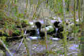
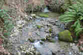
- Hutchinson Creek is 1.5 km long. The stream originates as sidehill runoff just above Panorama Drive and flows south. Hutchinson Creek enters a series of storm sewers near Panorama Drive which redistribute the flow into Turner, Hutchinson, and Noons Creeks. The stream 'daylights' about 750 meters downstream and flows south-southwest for another 750 meters until it enters the Port Moody tidal flats of Burrard Inlet.
History
- This area was logged between 1920-1940 following completion of the "Climax" high-grade locomotive and railway (City of Port Moody website).
- Coho (Onchorhynchus kisutch) and Chum (Onchorhynchus keta) were extirpated from Hutchinson Creek in the early 1970's by major stream alterations (Dunster and AXYS 1999). Coho and Chum are again resident in Hutchinson Creek since the beginning of stocking in 1990 by a small backyard hatchery (Hutchinson Creek Project).
- Industrial activities have polluted the marine environment of Port Moody Arm into which Hutchinson Creek flows, leading Environment Canada to identify this area as an "environmental hotspot" in 1992 (Dunster and AXYS 1999). These pollutants include the metals cadmium, chromium, copper, lead, and zinc (originating from metal coating, plastic stabilizers, paint pigments, and, to a lesser extent, pesticides and sewage), as well as organic compounds like oil and grease hydrocarbons and polycylic aromatic hydrocarbons (originating from oil refineries). Polychlorinated biphenyls (PCBs, used to produce plastics, inks, paints and pesticides but banned since the mid-1970s) persist in low concentrations throughout Port Moody Arm. In 1987, all of these pollutants occured in the highest concentrations near the Ioco refinery, decreasing in concentration towards Indian Arm and the Port Moody tidal flats (Environment Canada 1989).
- In 2000 a small bank stabilisation project was carried out on private property below Sentinel Road (City of Port Moody Environmental Services personal communication).
Watershed Use
- Residential: predominantly single-family residential houses with some condominiums.
- Institutional: Heritage Elementary School is within this watershed.
- Parks and recreation: Lower Hutchinson Ravine, Heritage Mountain Park, and a section of Shoreline Park are all within this watershed.
- CP Rail has a right-of-way near the stream mouth.
- Fish: resident Coastal Cutthroat Troat (Onchorhynchus clarki clarki) inhabit this stream. Coho (Onchorhynchus kisutch) and Chum (Onchorhynchus keta) were reintroduced in 1990 and are supplemented by the Hutchinson Creek Project.
- Wildlife: coyote, black bear, cougar, bobcat, mule deer, Douglas squirrel, red-back vole, and deer mouse are among the more prominent terrestrial animals (Dunster and AXYS 1999).
- Birds: several species of woodpeckers and raptors use the forest around Lower Hutchinson Creek Ravine, as well as American dipper. Near the mouth of Hutchinson Creek, shorebirds, waterfowl, and blue heron have been observed (Dunster and AXYS 1999, Robertson 2000). Historically, 131 bird species are known to inhabit the Port Moody area (Burke Mountain Naturalists 1994).
- Vegetation: Presently a secondary growth forest ranging in age from 60-80 years. Trees are a mix of western hemlock (Tsuga heterophylla), Douglas fir (Pseudotsuga menziesii), western red cedar (Thuja plicata), red alder (Alnus rubra), broad-leaf maple (Acer macrophyllum) and vine maple (Acer corcinatum). The understory is predominantly salmonberry (Rubus spectabilis), sword fern (Polystichum munitum) and huckleberry (Vaccinium spp.). Several plant communities are present which are of special concern (see below) (Dunster and AXYS 1999).
Concerns
- Culverting: Approximately one half of Hutchinson Creek has been enclosed in culverts and storm drains. A major culvert at the CP Rail right of way is impassable to fish, leaving only the lowest 100 metres of the stream available for coho and chum. Several other fish barriers exist further upstream.
- Stormwater: Stormwater runoff already accounts for 40% of in-stream flows: this has led to an erratic flow regime and increased peak flows (GVRD 1999). According to GVRD and GVSD studies carried out in 1996, the developed area of the watershed is predicted to increase from 40.2% in 1996 to 71.3% in 2036, and the average annual watershed flow is predicted to increase from 1529 mm to 1649 mm (GVRD 1999). More importantly, average annual stormwater runoff is predicted to increase from 1007 mm to 1384 mm (GVRD 1999). The predicted GVS&DD watershed classification falls from 'Fair' to 'Poor' in 2036 (GVS&DD 1999). However, these predictions may be exagerated, as they are based on population growth estimates for the entire region in 1996. In this case, the Hutchinson Creek watershed was "built out" by 2002, meaning that no undeveloped areas in the watershed are zoned for future development (City of Port Moody Environmental Services, personal communication).
- Plant communities of concern: the Western hemlock-flat moss, the Douglas fir / Western hemlock-salal, and the Western red cedar-sword fern commounities are present in this watershed and are provincially blue-listed (of special concern), while the Douglas fir-sword fern and the Western red cedar-salmonberry communities are also present and are provincially red-listed (endangered) (Robertson 2000).
- Animal species of concern: Great blue herons are provincially blue-listed (of special concern) (Dunster and AXYS 1999).
- Hutchinson Creek flows into the Port Moody tidal flats, a unique habitat which was designated an environmentally sensitive area in 2000 (Robertson 2000). A decline in the water quality of Hutchinson Creek could impact the shellfish and shorebirds which utilise the tidal flats.
Key Interest Groups
- Municipal Government: City of Port Moody
- Regional: GVRD, GVS&DD
- Provincial Government: Ministry of Transportation and Highways; Ministry of Environment, Lands and Parks; Burrard Inlet Environmental Action Program
- Federal Government: Fisheries and Oceans Canada, Environment Canada, Transport Canada
- Local NGO's: Hutchinson Creek Project, Port Moody Ecological Society
- BC Rail
- Various private landowners and occupants
- School District #43
Watershed Projects
- Ongoing water quality and fecal coliform monitoring by Port Moody Ecological Society.
- Hutchinson Creek Project has been operating a small scale enhancement and salmon rearing program since 1990.
Bibliography and Available Sources of Information
- Hutchinson Creek Project: contact Larry Cardus 604-469-9255.
- Port Moody Public Library. 604 469 4577.
- Port Moody Ecological Society Library. 604 469 9106.
- City of Port Moody Environmental Services. 604 469 4676.
- City of Port Moody website. http://www.cityofportmoody.com/
- Burke Mountain Naturalists. 1994. Wildlife Inventory of the Shoreline Park System, Port Moody, BC. Prepared for the City of Port Moody and the Burrard Inlet Environmental Action Program.
- Dunster and Associates Environmental Consultants Ltd., and AXYS Environmental Consulting Ltd. 1999. City of Port Moody Environmentally Sensitive Areas Management Strategy. Phase 1: An Inventory of Natural Areas. Prepared for the City of Port Moody.
- Environment Canada. 1989. Distribution and Environmental Impact of Selected Benthic Contaminants in Vancouver Harbour, British Columbia: 1985-1987. Pacific and Yukon Region Program Report 89-02.
- Greater Vancouver Regional District. 1999. Watershed flows and stormwater runoff: estimates for 1996 & 2036. http://www.gvrd.bc.ca/services/sewers/drain/Reports/stormwater_rpts_1997-2002/runoff/estimates.pdf
- Greater Vancouver Sewerage and Drainage District. 1999. Assessment of Current and Futrure GVS&DD Area Watersged and Catchment Conditions. http://www.gvrd.bc.ca/services/sewers/drain/Reports/stormwater_rpts_1997-2002/assessment/main_rpt/assessment_watersheds_catchments.pdf
- Robertson Environmental Services Ltd. 2000. City of Port Moody Environmentally Sensitive Areas Management Strategy. Phase 2: Development of Management Recommendations. Prepared for the City of Port Moody.