Seymour River Watershed
Summary
Characteristics:
- bordered by Lynn Creek Watershed (west) and the Indian River Watershed (east) in North Vancouver, BC [1]
- Three biogeoclimatic zones: coastal western hemlock zone, mountain hemlock zone, alpine tundra zone [5]
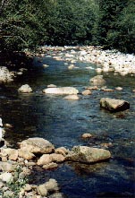
- Originates in the protected Seymour headwater area on Crown land, leased to the Greater Vancouver Water District (GVWD); flows south and discharges into Burrard Inlet [1]
- Tributaries (> 50 below dam alone). Main tributaries include: Maplewood, Hydraulic, Paton, Gibbens, Boulder, Burwell, Fannin, Orchid, Belfour, Sheba and Clipper Creeks [2,4]
- 1 % impervious areas for entire watershed; 41 % impervious areas in Lower Seymour due to heavy residential and industrial development [16]
Watershed Use:
- Reservoir storage capacity: 30 billion litres (the Seymour watershed provides about 40 % of the domestic water supply for municipalities within the GVRD), minimum flow agreement between DFO and GVRD: 20 ft3/sec [1]
- Recreational users: hiking, mountain biking, kayaking and canoeing, horseback riding, in-line skating, climbing, angling, target shooting
- Residential and industrial development in lower Seymour watershed
- The Seymour River Hatchery is located at the dam, 19 km upstream.
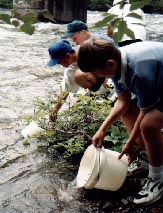
- Enhancement activities for salmonid species
- Wildlife includes: black bear, black-tailed deer, mountain goat, cougar, mink, tailed frog, western red backed salamander, red-breasted sapsucker, raven, bold eagle etc. [5]
- Fish: the Seymour River (up to the dam) supports runs of coho, pink, chum, chinook salmon, cutthroat and rainbow trout, Dolly Varden and winter run & summer run steelhead trout [4,5,6]
Concerns:
- Upper Seymour River (above dam) classified as wild [3]
- Lower Seymour River (below dam) classified as endangered, due to water diversion, urbanization, and other development related impacts (several of the 8 impact criteria apply to the Seymour) [3]
- Channelization: increased gradients due to straightening of mainstem, increases the need for floodproofing works (e.g. rip-rap) downstream [12,13]
- Dam cuts off > 30 km of valuable fish habitat
- Decreased water flow in river due to extraction for domestic water supply
- Water quality: direct discharge from storm drains (18 storm drains into lower Seymour River, periodically introducing pollutants, such as oil, grease, etc.), high nutrient runoff from equestrian center and from Maplewood farm (into Maplewood Creek) [10]
- Riparian areas: urban development in the lower Seymour, loss of riparian vegetation [10, 11, 12, 14, 15]
- Estuary greatly reduced and highly developed [2]
- Loss of gravel substrate (washout), as dam prevents recruitment from the upper Seymour Watershed